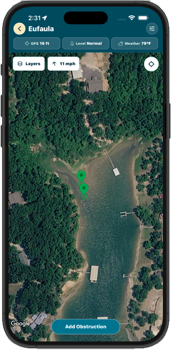
Mark Obstructions
Drop markers for stumps, rocks, shallow spots, and other hazards while you are on the lake.
 Buoy Pilot
Coming soon
Buoy Pilot
Coming soon
Lake Safety, Shared By Boaters
BuoyPilot helps boaters mark obstructions, review community reports, and improve the shared lake map over time.
Features
Drop markers for stumps, rocks, shallow spots, and other hazards while you are on the lake.
Use photos, GPS, and phone bearing to estimate hazards from a safer distance.
Other boaters can vote markers up or down to help improve report confidence.
Save markers on the water, then sync them when service is available.
How It Works
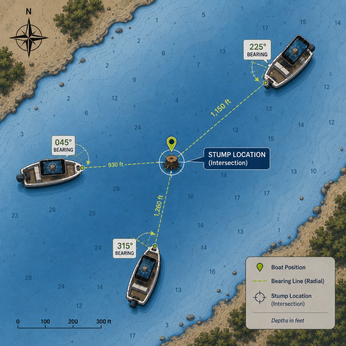
Triangulation
BuoyPilot can estimate the location of obstructions using photos taken from different angles. Each photo records your phone's GPS position and the direction you are pointing. Where those bearing lines meet, BuoyPilot estimates the obstruction's location.
Take more photos to improve the estimate, increase marker confidence, and earn extra contributor points.
Community Rated
Every report starts with a boater. As more people review a marker, vote on it, and add context, BuoyPilot can show which reports are gaining confidence and which may need another look.
Confirm markers that look useful or accurate.
Flag reports that may be misplaced, outdated, or unclear.
Community feedback helps boaters understand which reports have more support.
BuoyPilot rewards actions that make the map better. Add obstruction markers, upload extra photos, and receive upvotes from other boaters to build your contributor score.
Better reports earn more trust. Better photos improve marker confidence. Better contributors help the whole lake.